Dapingian
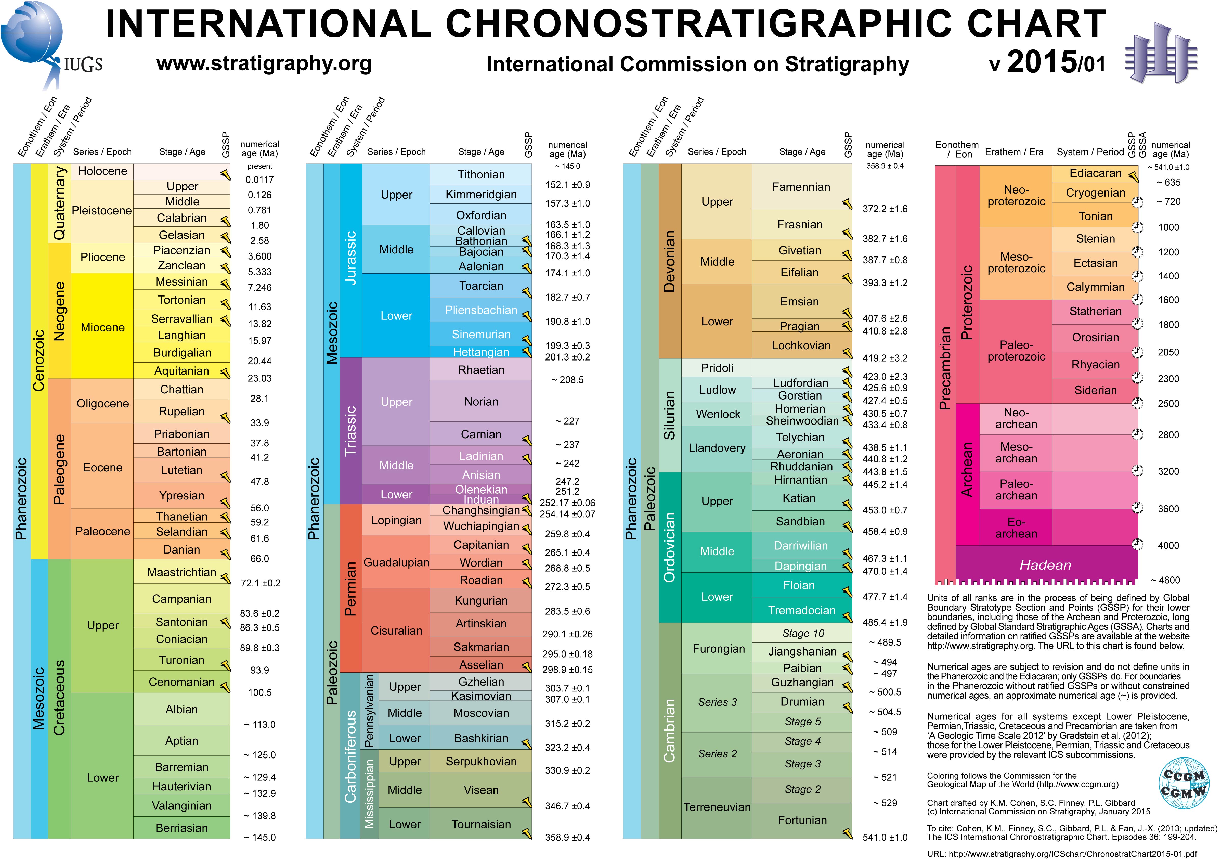
The Dapingian is the third stage of the Ordovician and the first stage of the Middle Ordovician. It is preceded by the Floian and succeeded by the Darriwilian. The base of the Floian is defined as the first appearance of the conodont species Baltoniodus triangularis which happened about 470.0 ± 1.4 million years ago. The Dapingian lasted for about 2.7 million years until about 467.3 ± 1.1 million years ago.[3]
Contents
Naming
The Dapingian is named after a village that lies nearby the Dapingian GSSP (Huanghuachang section, in Huanghuachang) where there is also an outcrop of similar rocks, the "Chenjiahe section" (formerly "Daping section") in Chenjiahe. The name was proposed in 2005.[4]
GSSP

The GSSP of the Dapingian is the Huanghuachang section (Lua error in package.lua at line 80: module 'strict' not found.), in Huanghuachang, Yichang, China. It is an outcrop of the Dawan Formation. The lower boundary is defined as the first appearance of the conodont species Baltoniodus triangularis in the type section. Radiometric dating has constrained the Floian-Dapingian boundary at 470.0 ± 1.4 million years ago.[3] The exact boundary lies 10.57 m above the base of Dawan Formation.[4][5]
Regional stages
The Dapingian overlaps with the Arenig, a geologic stage used in England.[2]
References
<templatestyles src="Reflist/styles.css" />
Cite error: Invalid <references> tag; parameter "group" is allowed only.
<references />, or <references group="..." />| Preceded by Proterozoic Eon | Phanerozoic Eon | |||||||||||
|---|---|---|---|---|---|---|---|---|---|---|---|---|
| Paleozoic Era | Mesozoic Era | Cenozoic Era | ||||||||||
| Cambrian | Ordovician | Silurian | Devonian | Carboniferous | Permian | Triassic | Jurassic | Cretaceous | Paleogene | Neogene | 4ry | |
- ↑ Lua error in package.lua at line 80: module 'strict' not found.
- ↑ 2.0 2.1 Lua error in package.lua at line 80: module 'strict' not found.
- ↑ 3.0 3.1 Lua error in package.lua at line 80: module 'strict' not found.Note: there is an apparent typo in the article referenced; they give the coordinates as "a latitude of 30°51’37.8"N and a longitude of 110°22’26.5"E", but their map and location description better corresponds to 30°51’37.8"N 111°22’26.5"E.
- ↑ 4.0 4.1 Lua error in package.lua at line 80: module 'strict' not found.
- ↑ Lua error in package.lua at line 80: module 'strict' not found.